Healthy soils
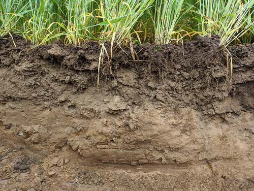
Soils in good condition mediate processes that underpin essential ecosystem services including plant growth, water quality and greenhouse gas mitigation. These functions are affected by complex interactions between biological, physical, and chemical components of the soil requiring indicators which are land use specific.
Understanding these interactions and their consequences for soil functions provides insights into the health of soils and soil’s ability to provide ecosystem services and allows us to identify indicators that can be used to support development of management practices to protect and enhance beneficial soil functions.
Soils are integral to several policy areas including climate change, agriculture, biodiversity, water quality, flood risk management, land use, and development planning.
Threats to healthy soil
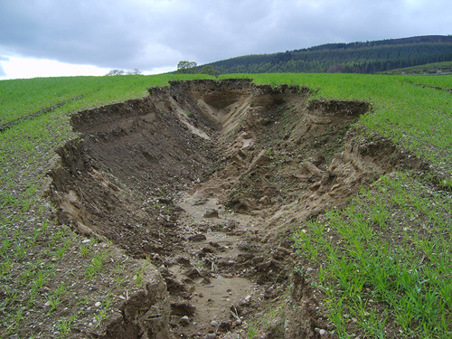
The concept of soil health has become more widely used in recent years and includes aspects of soil physics, chemistry and biology. More extreme weather events are leading to increased soil loss by erosion in Eastern Scotland (A state of knowledge overview of identified pathways of diffuse pollutants to the water environment - CREW (Scotland's Centre of Expertise for Waters) Report (2022)).
In arable fields tillage on sloped fields can make soil particularly vulnerable to erosions, and increasingly heavy machinery can cause soil compaction. Every year good quality arable land is lost to roads and urban development in Scotland. Soil sealing by concrete leads to biodiversity losses but also increased risks of flooding.
Across the UK arable soils are estimated to have already lost 40-60% of organic carbon. Reintegration of short-term leys and cover crops into arable rotations can help to halt the decline. Many agricultural soils are below optimum pH in terms of both crop and grassland production. This influences productivity, biodiversity and carbon cycling (Valuing Your Soils. A Practical Guide for Scottish Farmers - CREW publication (2016)).
Scottish Government – Strategic Research Programme 2022 – 2027
Scottish Government: Rural & Environment Science & Analytical Services new Strategic Research Programme 2022 to 2027 includes many soils related research projects and centres of expertise such as the ClimateXChange
A healthy soil can provide us with nutritious food, clean water, provide habits for biodiversity, and can slow the impacts of climate change. The Healthy Soils for a Green Recovery project aims to strengthen the evidence base to support and inform decision-making, practice and uptake for sustainable management and minimization of degradation and loss of Scotland’s soils, considering both their intrinsic value and the benefits (ecosystem services) that they provide. Society depends on healthy soils to deliver a broad spectrum of benefits. The programme will be producing a newsletter: Soil Sentinel at four monthly intervals throughout the projects. The first special edition for the Royal Highland show is available for download.
The CentrePeat project will deliver underpinning and integrated research for: (i) emission factor updates and activity data (WP1), (ii) the development of a specific Peatland Monitoring Framework (WP1&2), (iii) improved Natural Capital accounting (WP3), (iv) further development of the Peatland Code (WP4), and (v) improved carbon auditing tools that include climate risk assessments. An initial Evidence Mapping Review protocol is available.
The Agriculture Climate and Carbon project will provide new approaches for reducing greenhouse gas emissions from agriculture and land use in Scotland, establish a database of management activities contributing to the mitigation of GHG emissions, investigate new approaches to GHG mitigation, and assess the potential for land management activities to contribute to carbon sequestration. Engagement with stakeholders will explore barriers to uptake of mitigation measures. Environmental conditions necessitate adaptations in Scottish agriculture.
The Crop Improvement for Sustainable production in a Changing Environment project will investigate the development of crop species that are resilient to combinations of environmental stresses whilst using resources more efficiently, these include adaptions to climate change and abiotic stress. We will test the hypothesis that utilisation of latent diversity in crop species can improve both resource efficiency and stress tolerance.
Tools to support provenance of Scottish food produce will measure the Strontium isotopes in Scottish soils to create a map (isoscape) which can be used as an aid in determining where conventionally produced crops were grown. We will analyse their crops, waters and nutrients using isotope and chemical methods to see if they can be used for provenancing.
Integrated Socio-Environmental Modelling of Policy Scenarios for Scotland project develops the science and skills needed to work in an ‘agile’ way with policymakers and stakeholders on computer modelling at the whole-of-Scotland scale. We will work on a framework for monitoring soils; map our land capability and how it is affected by climate change; and simulate the effects of agricultural payments, trade, and technology change on rural businesses.
Understanding the dynamics of antimicrobial resistance genes (ARGs) flux in the soil, animals and humans in different fertilisation practices for grasslands project will investigate how different organic-based pasture fertilisation practices influence the spread of antimicrobial resistance to animals, humans and the environment.
Understanding the value of Scotland’s agricultural soil natural capital project will focus on the ecosystem services supplied by Scotland’s agricultural soils. These services will be linked to emerging soil health indicators and will be valued. The outcomes of the project will inform natural capital accounts and the contribution of soils to Scotland’s economy and national wellbeing.
Underpinning Capacity: Since 2011, the Scottish Government has supported specific activities to ensure the maintenance of scientific capacity, provide support to policy, maintenance of research platforms and to support long term and nationally important datasets through its Underpinning National Capacity funding. The soil-related datasets and platforms include the National Soils Archive of Scotland, the Scottish soil database and maps, the Environmental Change Network and the Centre for Sustainable Cropping. The funding supports the maintenance, enhancement and preservation of these long term datasets but also to make the data freely available to researchers, academics, students and the general public though various websites such as Scotland’s soils website and the UK Soil Observatory.
Arable soils
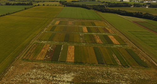
Arable soils are required to produce food, feed, and other bioproducts (e.g., medical & biofuels), with increasing pressure on farmers to improve the local environment, and reduce pollution (e.g. via run off), and to mitigate climate change through reduction in greenhouse emissions. In this process arable soils can be exposed to a sequence of rapid pressures, such as tillage, changing crop/plant cover, chemical inputs (nutrients, pesticides and herbicides) as well as impacts of local climate and climate change, with short and long-term effects on soil physical and biological status and its ability to support its primary functions. Long-term trials supporting research in this area are therefore vital.
At the James Hutton Institutes Balruddary farm two trials are hosted that support research into arable rotations, the Centre for Sustainable Cropping (CSC) and the Grieves House Tillage Trial (GH). Virtual tours of both trials and Scotland's Rural College (SRUC) Boghall, Craibstone and Tulloch trials are also available. Trials often look at harnessing ecological principles and physiologic mechanisms in diversifying agricultural systems for whole system sustainability and deploying nature-based solutions. We investigate the effects of these rotations and management practice, including tillage, including effects on carbon, and how to reverse declines in high-intensity arable cropping. These properties are also being investigated on a larger landscape scale.
Plant and soil interactions

The interface between roots and soil controls the dynamics of many of the earths most critical biogeochemical cycles including carbon, nutrients and water. An example of critical research focused on this zone is given by that focusing on root microbiome interactions in the rhizosphere and with particular reference to nitrogen cycles and phosphorus availability. Such research has shown that root hairs had large impacts on the porosity of the rhizosphere having impacts on water dynamics and aeration in this zone.
This information has parameterised models of rhizosphere development and phosphorus use under future field conditions. Of greatest importance was that we demonstrated that the presence of root hairs was critical for the ability of the crop to maintain water and phosphorus uptake under the severe drought conditions experienced in the field in 2018. In addition to this we have demonstrated that the ability of a crop to utilize organic P (Po) in soils is also impacted by the specific arbuscular mycorrhizal fungal (AMF) associations established with the plant roots, with different AMF species on the same root having different impacts on Po use. The type and function (e.g., phosphatase production) of bacteria recruited by mycorrhizae to a hotspot or hot-moment of Po availability in the soil was also shown to be selectable by AMF.
Such selections were shown to be facilitated by specific hyphal exudates and the movement of specific bacteria along fungal hyphae to the Po hot spots. In addition, this work has proven that mycorrhizae and associated bacteria are more effective at utilising Po than other root traits and that different AMF species have different strategies to acquire Po. Clearly, the ability of a crop genotype to form associations with mycorrhizae and other soil biological trophic levels will have profound effects on the sustainability of the cropping system. This work has been reviewed for a scientific audience and communicated to commercial stakeholders.
Aspects of root soil interactions have been picked up in EU projects such as the SolACE project, which has the aim of helping European agriculture face major challenges, notably increased rainfall variability and reduced use of nitrogen and phosphorus fertilizers for both economic and ecological purposes. Part of the consortium in SolACE came together to form a new consortium to bid for funds in Horizon Europe and this was successful with follow-on funds being awarded for the Roots 2 Resilience project which will start in September 2022 and run for 5 years.
Land-use
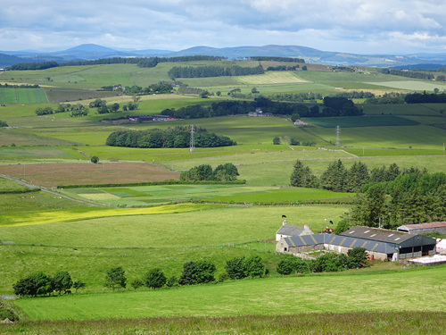
Around 70% of Scotland’s land area is under some form of agricultural management and woodland covers 18%. Scotland's soils hold more than 3,000 megatonnes of carbon, around 60% of which is held in deep peat soils. Restoring Scotland’s peatlands is a major priority for future land management. Implementing Scotland’s Land Use Strategy presents challenges with the multi-functional middle grade land which has to provide clean water, biodiversity, recreation and food production. Co-products from the whisky industry provides additional organic matter and trace elements for coarse textured arable and grassland soils.
Legacy soil datasets and maps
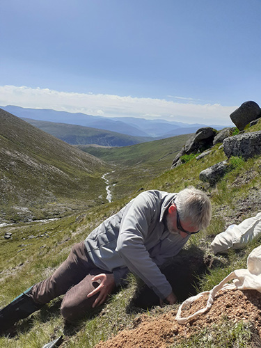
Scotland has a considerable amount of good quality soil data due to a long history of soil mapping, quantification of soil properties and long term field trials (up to 100 years) supported primarily by public funding. Soil maps are available in digital and hard copy that show the distribution of the different soil types found in Scotland. The soil maps and associated data are also freely available through various sites such as the SEFARI repository or UK Soil Observatory (UKSO). Allied to the soil maps, is a national soil database of around 15,000 soil profiles and an associated National Soils Archive of around 60,000 physical soil samples. In addition, the Scottish Soil Fertility database holds around 180, 000 agronomic sample data from cultivated land. Long term field trials (up to 100 years) provide information on crop rotations and response of crops to variations in soil pH. Trends in Comparisons have been made between carbon stocks, soil acidity and phosphorus and elemental status (Cu, Mo, Co, B, S and Zn) of Scottish soils has been undertaken.
Climate change
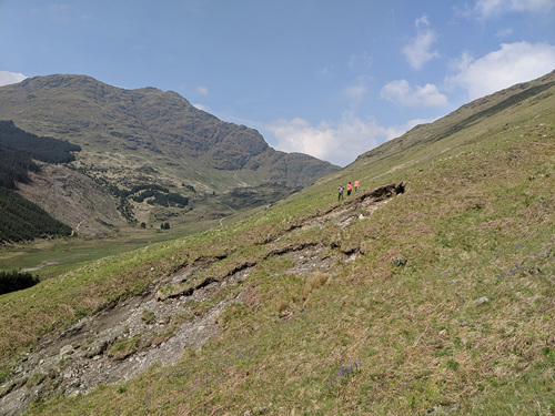
Climate change is affecting Scottish soils, through changing weather patterns, and increasing the occurrence of for extreme weather events, with consequences such as flooding, drought and soil erosion and compaction will large scale consequences. These changes need mitigation strategies. ClimateXChange is Scotland’s centre for expertise connecting climate change research and policy. Indicators are used to understand how well Scotland is managing the impacts of climate change.
Studies investigate the fluxes involved in the release of climate change related gases, consequences of climate change and mitigation strategies within for example, arable and grasslands and pasture farming, peat systems and forestry, together with overall land use choices. Following on from COP26 held in Glasgow the Centre for Sustainable Cropping (CSC) will be hosting a greenhouse gas observatory. The Climate Emergency is one of the key drivers for research under-taken at the CSC with the aim of enhancing soil biophysical quality and reducing dependence on mineral fertiliser inputs, pollution and losses through run-off, leaching, erosion and GHG emissions can be minimised. Research also includes establishing how we can use nature base solutions for carbon sequestration. The Glensaugh Climate Positive Farm is home to the climate positive farming initiative – tackling the climate and biodiversity crises with transformative farming and technological innovations
Nature based solutions to soil threats
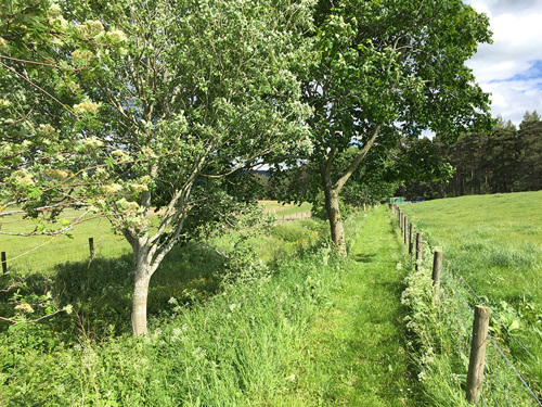
Some Nature Based Solutions (NBS) act directly on soil processes while others are implemented within the landscape to protect the wider environment. NBS can mitigate threats to soils while providing wider ecosystem benefits. A review of measures implemented in Scotland showed that by diversifying cropping systems there is potential to provide resilience to abiotic and biotic stresses, and mitigate against climate changes. A study of four NBS to inform policy assessed evidence for their impact on soil and vegetation carbon stocks, biodiversity and water quality. Current research is focussed on verification and modelling of NBS with respect to soil carbon and GHG emissions.
Preventing soil erosion is key to maintaining soil health however landscape measures such as riparian buffer zones can play a key role in mitigating impacts of soil loss. Achieving these benefits requires a “right measure right place” approach. Smarter BufferZ assesses novel buffer designs and where they are best located in the landscape to achieve maximum benefits. Conceptualising soil hydrological pathways is key to narrowing down buffer designs for a given riparian setting and pollutant loadings. Three modelling studies for Scotland used the concept of flow pathways and soil risks to waters to assess pollutant loads, phosphorus risk and the cost of erosion to farmers, land managers and society.
Understanding soil threats and drivers of change in soil processes is key to implementing Nature based solutions. A review for policy summarises the evidence found for the direction of change as a result of different pressures on upland habitats. The Land Capability for Agriculture (LCA), informs decision-making on land management, planning and valuation and a platform has been developed to assess and visualise changes in Land Capability for agriculture under future climatic conditions translating these findings for a wider audience.
Utility of Spatial data to delineate river riparian functions
Urban soils
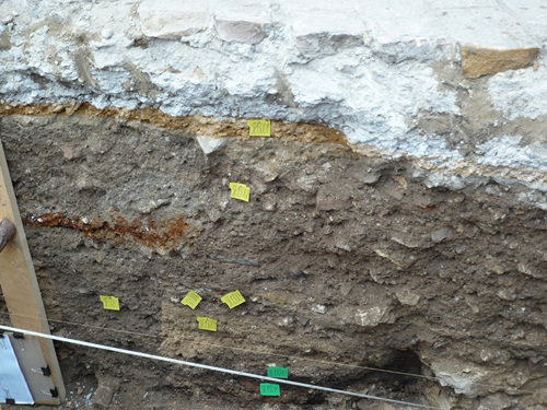
Scotland generates about a million tonnes of construction waste per year, much of which goes to landfill where its potential geochemical value is lost. Some of this material could be used as a basis to create soils, for certain non-food growth uses such as horticulture and urban greening. Our research tests locally produced construction waste and green waste mixed with compost to manufacture a ‘technosol’ which can mimic a real soil. Construction and demolition (C&D) fines material of smaller than 15mm particle size and green waste compost (GWC) mixtures form the base of our new soils. Our work shows that C&D material is similar in mineralogy to some existing Scottish soils, except that it has gypsum and calcite present in high concentrations.
Our tests show that the best combination of C&D and GWC is in a simple 50:50 ratio by volume, which achieves a strong and repeated grass growth, year-on-year. Analysis of extracted soil pore waters (water from gaps between soil particles) indicate elevated calcium sulphate concentrations, compared to usual Scottish topsoils, which reflects the presence of gypsum in the C&D material. We are working with industry partners to help select C&D materials with lower gypsum contents, so that we can refine the technical soils (technosol) recipe further. For more information, see; A geochemical and agronomic evaluation of technosols made from construction and demolition fines mixed with green waste compost
Forensics and pollutants (micro plastics)
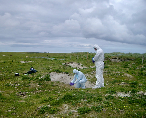
Forensic soil science is the application of soil science to the law (A Guide to Forensic Geology). It relates to both civil and has criminal law, helping investigate and provide evidence to a broad range of contexts including homicides, rapes, fly tipping, wildlife forensics, illegal trading, food and drink and art provenance, garden adulteration, contamination, plastics, metal disposal and characterisation of archaeological frauds. Soil forensic science links environmental science, soils, ecology, botany and eDNA and the law and delivers intelligence and evidence to the criminal justice system.
State of the art methods have been developed in the discipline of soil science and tested and applied successfully to legal situations across the world. Soil, water, dust, air, food, alcohol, honey and water have all been analysed and characterised to the highest quality standard, used in civilian and criminal courts across the world. Using a wide range of methods, questioned samples from fields, vehicles, tools and selected objects can be compared with known reference samples to ascertain likely origin and levels and compared wider with samples in the Scottish soils archive and related to data held within the Scottish soils database (Soil Forensics | James Hutton Ltd).
Ongoing research in soil science is developing new and improved quantitative methods that can be applied to increasingly smaller and older samples, allowing the approach to be used in cold cases in an increasing number of cases.
With impacts of climate change, there is an increasing need to recycle organic waste materials. However, these can also contain potentially toxic constituents such as organic chemicals, plastics, metals and pathogens, and so application of organic materials to land has the potential to increase levels of contaminants in soils and cause harm to the environment and affect soil biota, including in agricultural soils).
Analytical techniques can measure physical, chemical and biological contaminants, across long-term and spatial scales and can help deduce contaminant uptake pathways and track resistance genes in plants treated with organic fertilizers
The change of contaminants in agricultural soils amended by different organic wastes (sewage sludge, compost and manure) was studied and target contaminants included both chemicals e.g., diethylhexyl phthalate (DEHP) and antibiotic resistance genes (ARGs). Results showed that predicted environmental concentration (PEC) of (DEHP) were in good agreement with measured DEHP concentrations in treated soils were in the order: Sludge > Compost > Manure > Conventional. The organic wastes introduced the chemical and increased/accumulated the contaminants in the treated soils.
With multiple applications of organic fertilizers there were higher ARGs in comparison to the conventional inorganic fertiliser (NPK). Analytical chemical methods have allowed soil contaminants to be measured, quantified and compared. Ongoing research will further elucidate these processes for softer application of organic materials to land for health.
Digital soil mapping and remote sensing
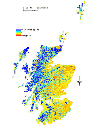
At the James Hutton Institute we use Digital Soil Mapping (DSM) techniques to map soil properties and functions, along with the associated uncertainty of prediction, by coupling information from soil surveys and soil legacy maps with Remote Sensing (RS) products and other environmental covariates. Data mining and machine learning are used to predict the spatial distribution of soil types, soil properties, and soil water regulatory functions. Moreover, DSM outputs are being used for conducting Digital Soil Assessments (DSA) designed to support the sustainable management of land and soil resources. Examples include generating maps of peat extent and condition in Scotland using combined DSM/RS approaches, and national spatially-disaggregated maps of soil hydrological classes that are used to predict hydrological response in ungauged catchments.
Biodiversity and microbial processes
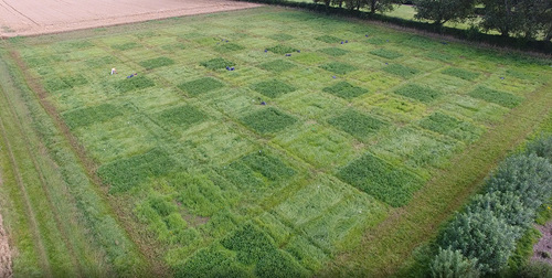
Soil health is a global priority with wide strategic importance and fundamental scientific relevance. While the concept of a ‘healthy’ soil depends on perspective and context, the basic fact about soil complexity remains. To address these challenges, researchers at Scotland’s Rural College and the James Hutton Institute are able to utilise long-term experimental field platforms, e.g., for assessing agronomy management regimes or impacts from major soil stressors. Working together and sharing these resources brings added value, expanding the scope of questions in this complex area. Specific examples that use the platforms include defining biological indicators for soil health, e.g., in a previous AHDB-funded project ‘Soil Biology and Soil Health Partnership’ and the generating a resource on UK Crop Microbiomes, assessing the impact of soil types (joint SRUC-Hutton involvement).
Soil biodiversity research is also undertaken in upland -systems using alternative. Researchers have also been involved in establishing the importance of soil biodiversity during policy briefings, such as Sustaining the soil microbiome.
Data and innovative monitoring
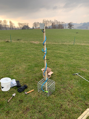
We use novel field sensing methods to improve the speed and cost-effectiveness of soil analysis and condition assessment, and to identify the best approaches to use under certain circumstances (On using the precise sensor). The equipment and techniques we are developing can allow multiple soil properties to be measured or estimated with a single scan. We have been developing machine learning and image analysis approaches for rapidly assessing topsoil condition using smartphones in the field, for example in previous work carried out in Ethiopia (Estimating soil properties from smartphone imagery in Ethiopia). We are also developing a method for Infrared (IR) Spectroscopic analysis in the field which will make soil monitoring possible on a far greater temporal and spatial scale.
Education

Education and training, including flexible learning approaches, are fundamental for developing the next generation of soils experts for policy, practice and academia. The SRUC/University of Edinburgh MSc in Soils and Sustainability attracts students from all over the world.
Our (soils) scientists provide material and activities for school children from primary to senior levels and are involved in public and industry engagement through events such as Arable Scotland, Potatoes in Practice, Fascination of Plants Day. Scotland has a strong community of PhD students studying both fundamental and applied aspects of soil science. See for example James Hutton Postgraduate School. The Scottish Farm Advisory Service provides events and training for farmers and land managers on soil health.
The institutes provide educational material on soils at multiple levels, for example Soil posters for Higher geography, Water posters for geography and environmental science and chemistry, Practical lessons on building bug hotels, SEFARI on line resources for primary, secondary and college students on climate change research, and soils of the crofts. Further links can be found on the SEFARI Online Education Resources Table
Policy and communication
Communication with policy and stakeholders is key in delivery of scientific outputs. Scottish Government funded research on soils delivered through direct engagement with policy teams (for example meetings, soils café’s, soil awareness sessions) and also regular bulletins (The Soil Sentinel). The programme will run from 2022-2027, based on the environment, natural resources and agriculture research strategy.
In addition to strategic research, government supports targeted research through Scotland’s Centres of Expertise – An example of this is ClimateXChange and recent work on soil health indicators and the mapping of soil governance in Scotland. The majority of research is conducted within 6 individual organisations, The James Hutton Institute, Scotland's Rural College (SRUC), Biomathematics and Statistics Scotland (BioSS), Moredun, The Rowett Institute and the Royal Botanic Garden Edinburgh. Collective dissemination of soils research from multiple organisations funded by Scottish Government is through the SEFARI Gateway, another of Scotland’s centres of expertise, to the public, industry, and stakeholders at a national scale. Collective dissemination offers the opportunity to agree and communicate key messages and avoid what can sometimes appear conflicting opinions when poorly explained.
Collaborative working extends beyond the main research institutes. For example, additional outputs (such as soil mapping data and point measurements) are delivered through Scotland’s soils website, with representation on the management group from research, government, Scottish Environment Protection Agency (SEPA), and NatureScot.
The event will showcase Scotland’s natural diversity, from the most varied geology to the resulting cultural landscapes. Colliding continents, erupting volcanoes and moving glaciers helped to shape this diversity in geological time.
Mountain habitats and soils – sensitive ecosystems
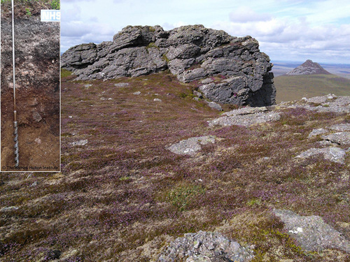
The alpine and subalpine soils of Scotland are confined to the exposed mountain summits and plateau areas where wet, very cold climatic conditions contrive to the slow development of soils and habitats. Upland and mountains soils are strongly influenced by the underlying hard geology and quaternary glacial and periglacial deposits.
Mountain habitats contain and support sets of rare species such as ptarmigan, netted mountain moth and mountain burnet, mountain willow species and many rare bryophytes and lichens. Slow growing heaths with lichens found on mountain soils are a common vista on many of Scotland’s mountains. These ecosystems are fragile and particularly vulnerable to change climate change and are easily tipped into degraded states by changes to land use. Despite appearing as desolate and wild, Scotland’s landscapes have evolved from millennia of farming, forestry and, more recently, game practices. Overgrazing by deer and sheep can reduce the potential of this habitat to expand and increase the carbon storage its carbon storage.
The Peatland of Scotland
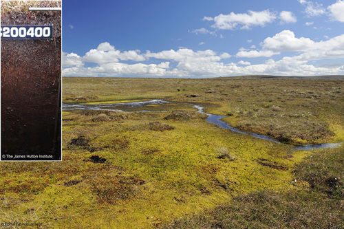
More than one fifth of Scotland’s land area is covered by peatland habitats characterised by peat soils (Histosols) and other peaty soils (with a shallower peaty or histic layer). Blanket bog habitats are widely developed in cool, oceanic climates on gently sloping ground with poor drainage. Found throughout the Scottish uplands, but rare globally, blanket peat is Scotland’s largest natural terrestrial carbon repository, holding around 1.6 billion tonnes of carbon. Raised bogs are rarer still, limited to the lowlands, where they appear as domes of peat growing to 10 metres or more in height. They are solely fed by rain-water, with a waterlogged, acidic surface lacking in nutrients.
Peat has been exploited as a source of fuel, a growing media for horticultural industry and is key element for production of ‘peaty’ whisky. During the past few centuries attempts have been made to drain and 'improve' peatlands for farming, gaming and forestry. A result of this is widespread erosion and degradation, which is exacerbated by climate change. When maintained or restored, these unique habitats can sequester huge amounts of carbon and store it for thousands of years. The national Peatland Action project, is a multi-annual investment by Scottish Goverment in peatland restoration which started in 2013 and has already set over 30,000 ha of peatlands on the path of restoration.
Heather moorland
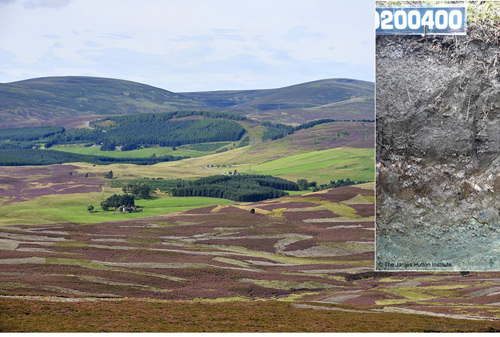
One of the most iconic landscapes of the Scottish uplands are heather moorlands. These moorlands typically develop on peaty, podzolic soils with low inherent fertility. Moorlands often present as mosaics of semi natural habitats combining peatland, heath and rough grazing. The way the land has been managed over centuries in response to the limitations of fertility, climate and accessibility contributes to the diversity of habitats we see today. Heather moorland has been maintained by a variety of practices including grazing and controlled burning (muirburn). Some land managers continue to use fire to create mosaics of heather patches of different ages to benefit game birds. There are concerns that these practices can lead to the erosion, degradation and loss of carbon stored in moorland.
Moorlands have experienced widespread pressures from land use changes including – forestry expansion, renewable energy production, increased grazing pressure from deer, and a decline in hill cattle grazing. Changes to management practices in these upland areas offers both opportunities and risks for increasing carbon sequestration and improving biodiversity.
Farmland – arable and improved grassland
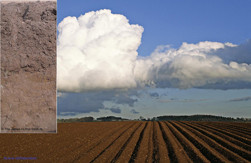
Arable farms account for approximately 8.5% of Scottish agriculture used land, with an average size of 110 ha. Within these holdings on average one fifth of the farm will be grassland. Arable farms are found on the most fertile and versatile soils (Land Capability class 1 to 3.1), predominantly in the lowlands of the central belt and eastern fringe of Scotland.
Agriculture represented 18.5% of Scotland's GHG emissions in 2020. Climate impacts, including changes in temperature and rainfall are already impacting on soil functions and affecting farming businesses. These changes will alter the patterns of Scotland’s agricultural land use with consequences for the resilience of food systems and issues such as flood risk. The changes could put at risk our farm wildlife and both the variety and the qualities of valued landscapes. The way the land is managed has many implications for the capacity of society at large to adapt to climate change. Environmental outcomes can help make land based businesses more resilient to climate change and future challenges (Preparing the Evidence Base for Post-Brexit agriculture in Scotland and Nature Restoration at the Landscape Scale project). Promoting soil health through better land management, such as targeted nutrient use, is essential to maximise agricultural efficiency and minimise losses to the environment. (Farming for a better climate and Farming Advisory Service).
Farmland – grassland / livestock
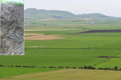
Grass-fed livestock farming is widespread across Scotland, ofton on less productive land but across a range of local soils types. In addition to the managed leys of highly productive grassland, such farms often include species-rich grasslands of conservation value. These are usually found on land that has had limited inputs of lime, synthetic fertiliser and herbicide and is subject to well-managed grazing.
Dairy in Scotland represents 1.5% of Scotland's utilised agricultural areas (UAA), with nearly 85% of this on mainly grassland farms. Dairy farmers generate more income per ha from agricultural activities and from agri-environment schemes on average than cropping farms. These holdings average 149ha and are found on mostly in the south west and central belt on gleyed and more peaty soils.
Livestock (lowland) cattle and sheep account for nearly 7% of Scotland's UAA. Average farm holdings are 57ha.These farms are often more diversified yet have less uptake of governmental agri-environmental schemes than dairy farms.
Hill sheep and cattle farming typically occurs in less favourable areas (with lower soil fertility and limited cropping capacity) and account for 50% of Scotland's UAA. Forestry is also significant on these farms as is strong engagement in agri-environment activities including peatland restoration.
Environmental outcomes can help make land based businesses more resilient to climate change and future challenges. Correct soil management and targeted nutrient use are essential to maximise agricultural efficiency and minimise losses carbon and nutrients to the environment.
Caledonian Pinewood forest
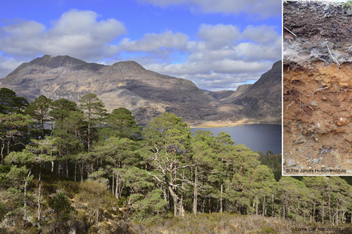
Caledonian pinewoods occur on thin, infertile, mineral soils across Scotland, often found on Humus Iron podzols. Pinewoods are not as biodiverse compared to some more fertile woodland types such as lowland oak stands or ash-rich woodlands. However, they do support characteristic species including capercaillie, black grouse and Britain’s only endemic species of bird, the Scottish crossbill.
Native pinewood forest demonstrates the great potential for Scottish forests and woodlands to sequester carbon and retain a high biodiversity values. Evidence shows that more carbon can be stored if woodland expansion occurs on mineral soils and has limited soil disturbance during establishment, felling and other forest operations.
Nature in the city
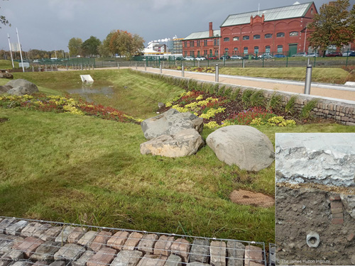
In the modern urban environment, well planned infrastructures optimising the use of planted areas – or “greening” - can have a high dividend of valuable benefits.
The impact of past activities is reflected in the complex nature of urban soils, which range from semi-natural soils in parkland areas and other long-established green spaces to highly disturbed technosol and anthrosol soils developing on a variety of materials from many different sources. Such soils create unique problems for their management. Understanding and managing urban soil is central to developing solutions to help improve urban drainage, promote sustainable use of water, transform vacant and derelict land, create new greenspaces to help increase carbon capture, and to improve wellbeing.
Where soil and water meet
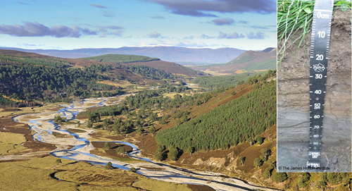
Our lochs, rivers and wetlands support many important habitats and species, and our wetland vegetation also helps to maintain water quality. Clean water is a vital resource not just for people, but also for our plants and animals.
The protection of the water environment is intricately link to good management of our land. Soil filters water helping to purify it and prevent water diffuse pollution. It also slows down the flow of rainwater to rivers and is key to preventing or reducing the risks of flooding.
Land-based activities can posed a risk to not just soil its impact on but also air and water. Hence Reducing risk of soil loss from erosion will help prevent diffuse pollution and keeping soil and nutrients in the field available for plants and crop growth.
Giving space to nature either by maintain functional geomorphology processes or by allowing nature engineer like beavers to adapt water flow can play an important role in helping to control the occurrence and intensity of flood events. Reducing sediment loads will help maintain quality of our lochs and rivers to protect its unique biodiversity.
Scotland machairs
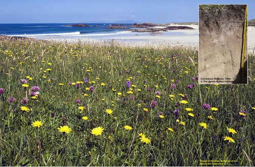
Machair is a Gaelic word meaning fertile, low-lying grassy plain. Machair is the common name of one of the rarest soil and habitat type in Europe, found on the exposed west facing shores of Scotland. Machairs are formed where lime-rich shells sand washed up thousands of years ago by the sea, are eroded from dunes by powerful winds, spreading the sand well inland. The unique cultural habitat that develops on these rich calcareous soils has been for millennia associated with traditional crofting farming communities - a form of tenanted agricultural smallholdings, centered on liverstock, particular to Scotland. The traditional low intensity system uses natural fertilisers such as seaweed and cow dung, has low levels of grazing by traditional breeds of cattle.
This habitat supports a number of important flora and fauna species such as corncrake and the great yellow bumblebee. Uncultivated and fallow machairs are colonised by rich blankets of flowers including rare orchids and wetter marsh species were the sand has accumulated over inland peat deposits.
Machairs are at risk from sea-level change, development and intensification of farming practices.


 The 22nd


