View the map or download the data
What is it?
What do I see on my screen?
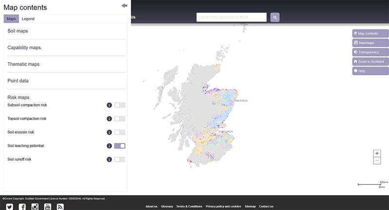
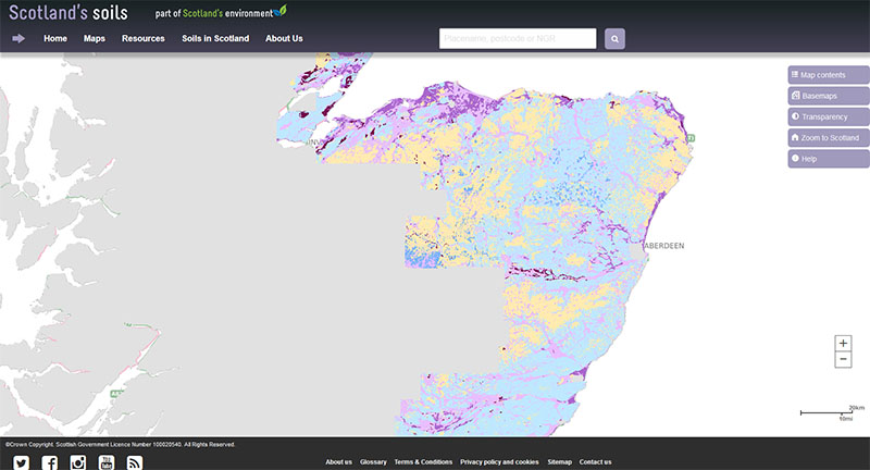
The map shows the risk of potential pollutants and nutrients leaching through the soil to ground and surface waters. It covers most of Scotland’s cultivated agricultural land area.
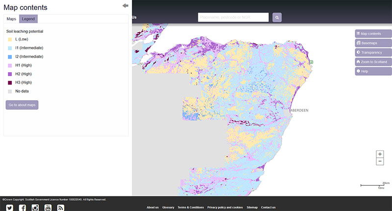
Map legend
The soil leaching potential is shown in 3 main classes: Low, Intermediate or High. The Intermediate class is subdivided into 2 classes while the High class is subdivided into 3 classes. Soils over current and restored mineral workings and in urban areas that are often disturbed or absent are assumed to have little ability to retain potential pollutants and so are classified as having a high leaching potential.
| Low soil leaching potential: soils in which potential pollutants are unlikely to move down through the soil due to low permeability. |
 |
L |
Deep soils with low permeability due to medium to fine textured subsoils or thick organic surface layers that can absorb or prevent contaminants from infiltrating |
| Intermediate soil leaching potential: soils with a moderate ability to retain potential pollutants and which allow some pollutants and liquids to move through the soil. I1 has a greater leaching potential than I2. |
 |
I2 |
Deep, permeable, medium textured soils with high topsoil organic matter contents that can possibly transmit non- or weakly-adsorbed pollutants and liquid discharges |
 |
I1 |
Deep, permeable, medium textured soils that can possibly transmit a wide range of pollutants |
| High soil leaching potential: soils with very little ability to retain potential pollutants and which allow pollutants and liquids to move rapidly down through them to underlying groundwater. H1 has a greater leaching potential than H2 which in turn has a greater leaching potential than H3. |
 |
H3 |
Coarse textured or moderately shallow soils with some ability to retain potential pollutants because of their greater organic matter content |
 |
H2 |
Deep, permeable, coarse textured soils with little ability to retain potential pollutants |
 |
H1 |
Soils with little ability to retain potential pollutants because they are either shallow or allow flow directly to rock, gravel or shallow groundwater |
What is included in the digital dataset?
The digital dataset provides information on the soil leaching potential in three categories (Low, Intermediate and High). Both the Intermediate and High classes are subdivided depending on the soil properties that affect its ability to retain potential pollutants.
How was the map / dataset created?
The soil leaching potential gives information on the likelihood of a potential pollutant that is applied to the soil surface filtering through the soil and reaching a water course or ground water. It depends on how easily water can move through the soil and the capacity of the soil to retain elements and compounds. These in turn depend on fundamental soil characteristics such as depth to a slowly permeable layer, soil porosity, flow pathways through the soil and degree of binding capacity of the organic matter and clays within the soil.
Each of the soils in the Soil Map of Scotland (partial cover) dataset was grouped into 3 classes based on Lewis et al. (2000) and Lilly, A & Baggaley, N.J. (2014). The classification uses information from the Hydrology of Soil Types (HOST) classification (Boorman et al., 1995) and takes account of the clay and the organic matter contents of the soil.
Where the soil map units were described as complexes (that is, more than one soil type is found in the area), the precautionary principle was applied such that the soil at most risk of leaching was used to describe the whole map unit. This follows a different approach for complex map units to that used to derive the soil leaching potential for Private Water Supplies which used the leaching potential of the dominant soil in the map unit.
How is it updated?
The map will be updated when new areas of digitised soil information become available.
Using the map
What can I do?
You can click on the map, or insert a grid reference or post code, to find out the soil leaching potential class at that point. You can also download the map data from the James Hutton Institute data download page.
Be aware: This map is produced at a fixed scale; zooming-in does not change the resolution of the map.
Please cite as: Lilly, A. and Baggaley N.J. 2018. Soil leaching potential map of Scotland (partial cover). James Hutton Institute, Aberdeen.
This work was partly funded by the Rural & Environment Science & Analytical Services Division of the Scottish Government.
Technical and reference material
Boorman, D.B., Hollis, J.M and Lilly, A. 1995. Hydrology of soil types: a hydrologically-based classification of the soils of the United Kingdom. Institute of Hydrology Report No.126. Institute of Hydrology, Wallingford.
Lewis, M.A., Lilly, A and J.S. Bell. 2000. Groundwater vulnerability mapping in Scotland: Modifications to classification used in England and Wales. In: Groundwater in the Celtic Regions: Studies in Hard Rock and Quaternary Hydrogeology. Eds. N.S. Robins and B.D.R. Misstear Geological Society Special Publication No. 182. pp 71-79.
Lilly, A & Baggaley, N.J. 2014. Developing simple indicators to assess the role of soils in determining risks to water quality, CREW project number CD2012_42.
DWQR: Technical Guidance and Information
SSDI Metadata file
This page was last updated on 18 May 2018
Adobe Acrobat Reader is the free, trusted leader for reliably viewing, annotating and signing PDFs.
Download Adobe Acrobat Reader


