Soil maps
Soil maps show the distribution of soils across the land. Soil maps were originally produced by field surveyors who walked over the landscape, looking at the soils by digging small pits and drawing boundaries between the different soil types they saw.
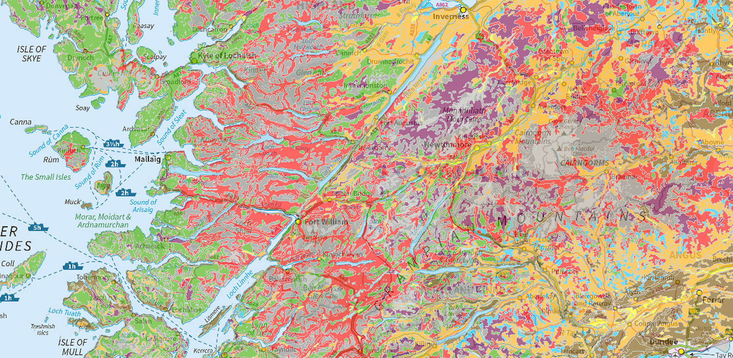
National soil map of Scotland
National coverage of the main soil types across Scotland mapped originally at 1:250 000 scale. The map is based on data collected between 1947 and 1981.
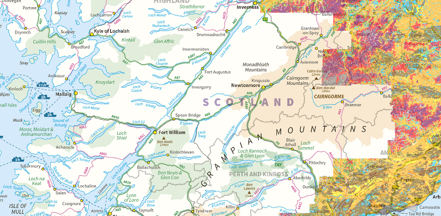
Soil map of Scotland (partial cover)
This map covers most of Scotland’s cultivated agricultural soils and some of the adjacent uplands. The soils were originally mapped at the 1:25 000 scale.
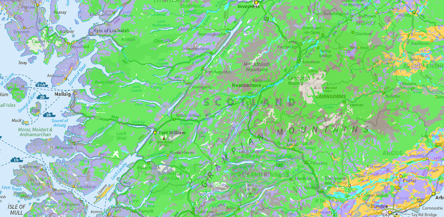
World Reference Base soil map
The World Reference Base is an international system for soil classification and correlation developed under the direction of the Food and Agriculture Organization of the United Nations (FAO).