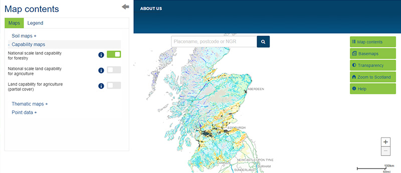
View the map or download the data
What is it?
What do I see on my screen?
The National scale land capability for forestry map provides information on the potential for land to grow trees based on a number of factors including soil, climate and topography.
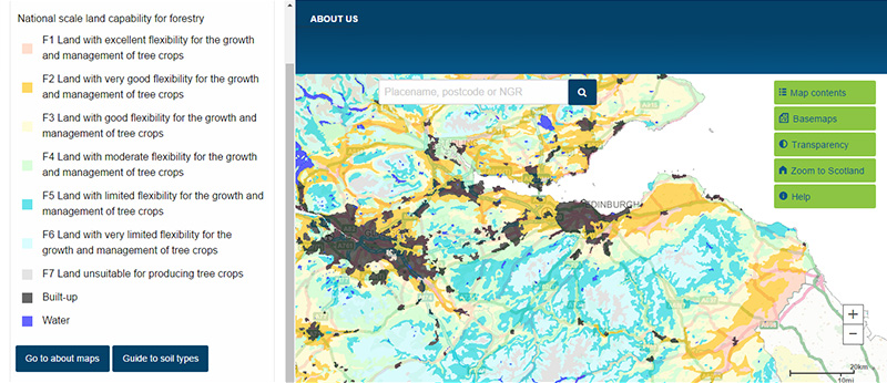
Map legend
The map shows the seven classes of land capability for forestry
 |
Class F1 - Land with excellent flexibility for the growth and management of tree crops |
 |
Class F2 - Land with very good flexibility for the growth and management of tree crops |
 |
Class F3 - Land with good flexibility for the growth and management of tree crops |
 |
Class F4 - Land with moderate flexibility for the growth and management of tree crops |
 |
Class F5 - Land with limited flexibility for the growth and management of tree crops |
 |
Class F6 - Land with very limited flexibility for the growth and management of tree crops |
 |
Class F7 - Land unsuitable for producing tree crops |
What is included in the digital dataset?
The digital dataset can be downloaded and contains information on the 'class' of soil. Classes range from F1 (land offering excellent flexibility for growth and management) to F7 (land unsuitable for producing trees) with seven types of limitations, these being climate, wind throw, nutrients, topography, droughtiness, wetness and soil.
How was the map /dataset created?
The map was based on a reclassification of the 580 soil map units of the National soil map of Scotland with limited field validation. A set of rules were applied to each of the soil map units combined with information on climate and relief to assign the map units to a capability class for forestry.
The map should be cited as: 'Soil Survey of Scotland Staff. (1988). Land Capability for Forestry of Scotland at a Scale of 1:250 000. Macaulay Land Use Research Institute, Aberdeen. DOI: 10.5281/zenodo.6322608'.
How is it updated?
No updates available to date
Using the map
What can I do?
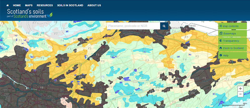
You can click on the map, or insert a grid reference or post code, to find out more about the land capability for forestry at that location. You can also download the map data.
This map covers the entire country and it can be used to determine the areas most suited to growing commercial and broadleaved trees.
Be aware: This map is produced at a fixed scale; zooming-in does not change the resolution of the map.
Accessing original copies of the maps
Copies of the original maps were published as five separate sheets with associated handbooks. The maps are still available for purchase from The James Hutton Institute website.
Technical and reference material
- Land Capability for Forestry in Britian
- Land Capability for Forestry - Northern Scotland Field - Book 3 (1989)
- Land Capability for Forestry - Western Scotland Field - Book 4 (1989)
- Land Capability for Forestry - Eastern Scotland Field - Book 5 (1989)
- Land Capability for Forestry - South West Scotland Field - Book 6 (1989)
- Land Capability for Forestry - South East Scotland Field - Book 7 (1989)
- Land capability for forestry SSDI metadata
This page was last updated on 25 May 2017
Adobe Acrobat Reader is the free, trusted leader for reliably viewing, annotating and signing PDFs.
Download Adobe Acrobat Reader


