View the map or download the data
Using the map
What can I do?
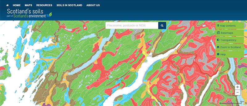
You can click on the map, or insert a grid reference or post code, to find out more information about the soil type found there. You can also download the map data for the whole of Scotland.
Be aware: This map was produced at a fixed scale; zooming-in does not change the resolution of the map.
What is it?
What do I see on my screen?
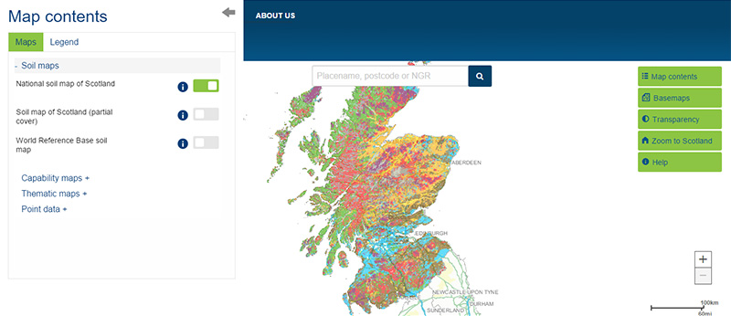
National coverage of the main soil types across Scotland mapped originally at 1:250 000 scale. The map is based on data collected between 1947 and 1981.
Map legend and soil classification
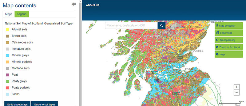
Legend
The legend for the digital version of the National soil map of Scotland on this website shows 'generalised soil types'. These soil types are a simplification of the more complex soil classification used to map the soils at a 1:250 000 scale, because it is not practical to show all the individual soil types on a small, online map. The more complex classification is obtained when you interrogate or download the map.
Classification of Scotland's Soils
Soils are classified by grouping similar soils together according to their key characteristics. In Scotland, soil classification is based on the soil properties you can see in the field (for example, colour, texture) and on the arrangement and nature of the different horizons (layers) within the soil. Minor revisions to the soil classification were made in October 2013.
Soil map unit (QMUNIT)
The National soil map of Scotland shows the distribution of Soil Mapping Units (QMUNIT). The QMUNIT is a number identifying a unique combination of parent material, component soil types and associated landforms. Over 580 combinations are found in Scotland. The colour of each map polygon indicates the dominant soil type for each of the map unit combinations. You can find out more about the map units in the database.
What is included in the digital dataset?
The digital dataset is made up of three layers: soil boundaries, lochs and coastline. Over 20,500 individual soil polygons are grouped into more than 580 QMUNITs. Data reported includes information on typical soil properties associated with the soils in the individual QMUNITs.
How was the map / dataset created?
The 1:250 000 National soil map of Scotland was created by the Macaulay Institute (now The James Hutton Institute) based on information collected from field surveys carried out between 1947 and 1981. This digital dataset is adapted from the original 1:250 000 scale soil map series.
The soil classification used is based on how the soil has formed over thousands of years meaning that, while relatively recent changes such as the addition of nutrients to the soil may change some soil properties, they do not fundamentally change the soil type. This means the map is still an important and relevant source of information today.
The dataset should be cited as: 'Soil Survey of Scotland Staff (1981). Soil maps of Scotland at a scale of 1:250 000. Macaulay Institute for Soil Research, Aberdeen. DOI: 10.5281/zenodo.4646891'.
How is it updated?
Since its first release the dataset has been corrected for minor errors and spatial boundary errors. In 2013, the soil classification underwent some minor changes to provide a consistent naming of soil types across a variety of digital and spatial datasets. Only additional minor updates are likely in future.
Accessing original copies of the maps
The original maps were published in the 1980s as 7 separate sheets with an associated handbook.
- Orkney and Shetland: A4 / Full size / Soil handbook
- The Outer Hebrides: A4 / Full size / Soil handbook
- Northern Scotland: A4 / Full size / Soil handbook
- Western Scotland: A4 / Full size / Soil handbook
- Eastern Scotland: A4 / Full size / Soil handbook
- South West Scotland: A4 / Full size / Soil handbook
- South East Scotland: A4 / Full size / Soil handbook
Technical and reference material
This page was last updated on 11 Oct 2024
Adobe Acrobat Reader is the free, trusted leader for reliably viewing, annotating and signing PDFs.
Download Adobe Acrobat Reader


