View the map or download the data
What is it?
What do I see on my screen?
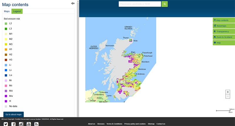
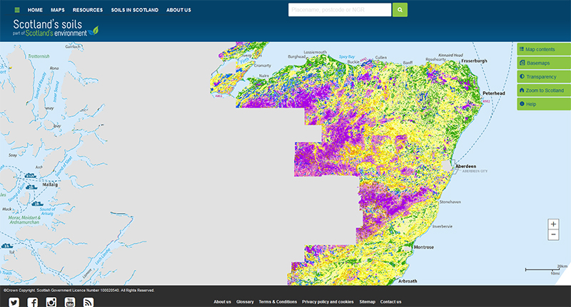
The map shows the risk of a bare soil being eroded by water under intense or prolonged rainfall. It covers most of Scotland’s cultivated agricultural land area. Soils with mineral topsoils have been classified separately from those with organic (peaty) surface layers.
Map legend
The risk of soil erosion is shown in 3 main classes for soils with mineral topsoils: Low, Moderate or High. Each main class is divided into 3 subclasses (L1-3, M1-3 and H1-3) with the higher the number in each class indicating a greater risk of erosion within that class due to increases in slope, soil textures becoming more coarse and / or the soils becoming less able to absorb rainfall.
The risk of soil erosion for soils with organic (peaty) surfaces is also shown in 3 classes: Low, Moderate or High. The Low and Moderate classes are divided into subclasses (Li-iii and Mi–iv) with the higher the number in each risk class indicating a greater risk of erosion within that class due to increases in slope and/or the soils becoming less able to absorb rainfall.
Mineral soils
| Low erosion risk: the combination of soil texture, the capacity to store rainfall and almost level to moderate slopes mean that these soils are at a low risk of erosion. |
 |
L1 |
Fine textured soils with high absorption capacity on almost level slopes. The combination of absorption capacity soil texture and slope means that this class has not been mapped |
 |
L2 |
Medium and fine textured soils with moderate to high absorption capacity on almost level to gentle slopes |
 |
L3 |
Coarse, medium and fine textured soils with high to low water absorption capacity on almost level to moderate slopes |
| Moderate erosion risk: the combination of soil texture, the capacity to store rainfall and almost level to steep slopes mean that these soils are at a moderate risk of erosion. |
 |
M1 |
Coarse, medium and fine textured soils with high to low water absorption capacity on almost level to moderately steep slopes |
 |
M2 |
Coarse, medium and fine textured soils with high to low water absorption capacity on almost level to steep slopes |
 |
M3 |
Coarse, medium and fine textured soils with high to low water absorption capacity on gentle to steep slopes |
| High erosion risk: the combination of soil texture, water absorption capacity and moderate to steep slopes mean that these soils are at high risk of erosion |
 |
H1 |
Coarse, medium and fine textured soils with high to low water absorption capacity on moderate to steep slopes |
 |
H2 |
Coarse and medium textured soils with moderate to low water absorption capacity on moderately steep to steep slopes |
 |
H3 |
Coarse textured soils with low water absorption capacity on steep slopes |
Organic (peaty) soils
| Low erosion risk: soils with peaty surface layers that can allow a moderate degree of infiltration and on almost level to moderate slopes. |
 |
Li |
Soils with a peaty surface layer with high absorption capacity on almost level slopes |
 |
Lii |
Soils with a peaty surface layer with low to high absorption capacity on almost level to gentle slopes |
 |
Liii |
Soils with a peaty surface layer with low to high absorption capacity on almost level to moderate slopes |
| Moderate erosion risk: soils with peaty surface layers that can allow a degree of infiltration and are on gentle to steep slopes |
 |
Mi |
Soils with a peaty surface layer with low to high absorption capacity on gentle to moderately steep slopes |
 |
Mii |
Soils with a peaty surface layer with low to high absorption capacity on moderate to steep slopes |
 |
Miii |
Soils with a peaty surface layer with a low to moderate absorption capacity on moderately steep to steep slopes |
 |
Miv |
Soils with a peaty surface layer with a low absorption capacity on steep slopes |
| High erosion risk: Peat soils |
 |
H |
Peat soils on all slopes |
What is included in the digital dataset?
The soil erosion risk dataset gives information on the likelihood of a bare soil being eroded under intense or prolonged rainfall. Mineral and organic soils are treated separately and are each divided into three main classes depending on the severity of the risk. These main classes are then subdivided to give more detail.
How was the map / dataset created?
The soil erosion risk depends on the soil texture and its capacity to absorb rainfall as well as the slope of the land. The slope determines how erosive overland flow could be with steeper slopes leading to faster runoff.
Each of the soils in the Soil Map of Scotland (partial cover) dataset was assessed in terms of topsoil texture and grouped in broad categories with the more coarse textured soils being most susceptible to breaking down under intense or prolonged rainfall. The soil’s ability to absorb rainfall was assessed using the soil porosity, depth to a slowly permeable layer and inherent wetness (derived from the Hydrology of Soil Types (HOST) classification (Boorman et al., 1995). The Land Cover of Scotland map (1988) was used to identify which soils were likely to be uncultivated and have an organic topsoil from those that were likely to be cultivated or uncultivated and have a mineral topsoil. Where the LCS88 map showed a mixture of both semi-natural and cultivated land cover, the latter was taken to represent the land cover class. The slope characteristics were derived from the Ordnance Survey Open data 50m DTM, OS data © Crown copyright and database right (2017). The map is a 50m raster grid. These characteristics were combined and the values obtained assigned to a risk category.
Where the soil map units were described as complexes (that is, more than one soil type is found in the area), the precautionary principle was applied and the soil within the complex most at risk of erosion was used to describe the whole map unit.
How is it updated?
The map will be updated when new areas of digitised soil information become available.
Using the map
What can I do?
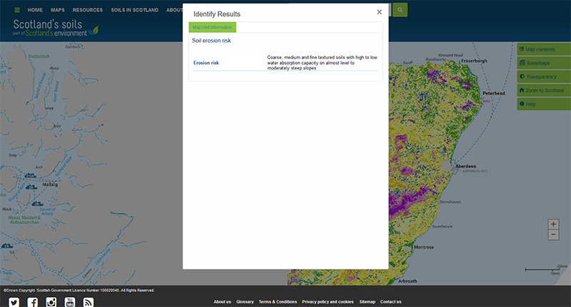
You can click on the map, or insert a grid reference or post code, to find out the risk of soil erosion occurring at that point. You can also download the map data from the James Hutton Institute data download page.
Be aware: This map is produced at a fixed scale; zooming-in does not change the resolution of the map.
Please cite as: Lilly, A. and Baggaley N.J. 2018. Soil erosion risk map of Scotland (partial cover). James Hutton Institute, Aberdeen.
This work was partly funded by the Rural & Environment Science & Analytical Services Division of the Scottish Government.
Technical and reference material
Boorman, D.B., Hollis, J.M and Lilly, A. 1995. Hydrology of soil types: a hydrologically-based classification of the soils of the United Kingdom. Institute of Hydrology Report No.126. Institute of Hydrology, Wallingford.
Lilly, A & Baggaley, N.J. 2014. Developing simple indicators to assess the role of soils in determining risks to water quality, CREW project number CD2012_42.
Lilly, A., Hudson, G., Birnie, R.V. and Horne, P.L. 2002. Inherent geomorphological risk of soil erosion by overland flow in Scotland. Scottish Natural Heritage Research, Survey and Monitoring Report No.183.
SSDI Metadata file
The table below shows how the soil texture, water absorption capacity and slope affect erosion risk class.
| Texture |
Water absorption capacity |
Slope |
| |
|
Almost level |
Gentle |
Moderate |
Moderately steep |
Steep |
| 1-2 o |
2-5 o |
5-10 o |
10-18 o |
18-30 o |
| Erosion risk class |
| Coarse |
High |
L3 |
M1 |
M2 |
M3 |
H1 |
| Moderate |
M1 |
M2 |
M3 |
H1 |
H2 |
| Low |
M2 |
M3 |
H1 |
H2 |
H3 |
| Medium |
High |
L2 |
L3 |
M1 |
M2 |
M3 |
| Moderate |
L3 |
M1 |
M2 |
M3 |
H1 |
| Low |
M1 |
M2 |
M3 |
H1 |
H2 |
| Fine |
High |
L1 |
L2 |
L3 |
M1 |
M2 |
| Moderate |
L2 |
L3 |
M1 |
M2 |
M3 |
| Low |
L3 |
M1 |
M2 |
M3 |
H1 |
| Peaty |
High |
Li |
Lii |
Liii |
Mi |
Mii |
| Moderate |
Lii |
Liii |
Mi |
Mii |
Miii |
| Low |
Liii |
Mi |
Mii |
Miii |
Miv |
| Peat |
Low |
H |
H |
H |
H |
H |
This page was last updated on 18 May 2018
Adobe Acrobat Reader is the free, trusted leader for reliably viewing, annotating and signing PDFs.
Download Adobe Acrobat Reader


