View the map or download the data
What is it?
What do I see on my screen?
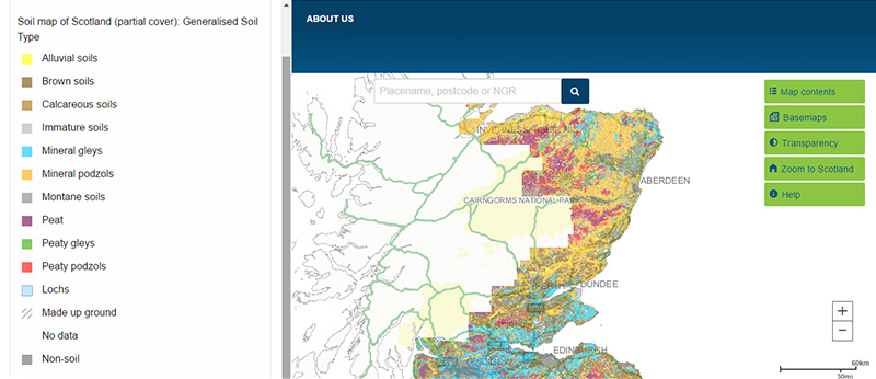
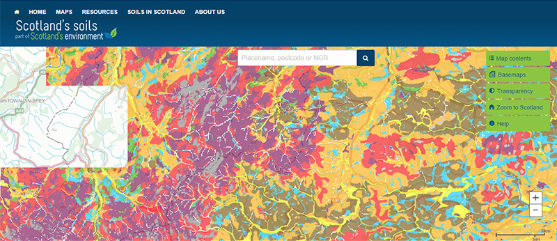
This map covers most of Scotland’s cultivated agricultural soils and some of the adjacent uplands. The soils were originally mapped at the 1:25 000 scale. The Soil map of Scotland (partial cover) shows more detail than the National soil map of Scotland. The map provides soil information based on the 2013 soil classification.
Map legend and soil classification
Legend
The legend for the digital version of the Soil map of Scotland (partial cover) on this website shows 'generalised soil types'. These soil types are a simplification of the more complex soil classification used to map the soils at a 1:25 000 scale, because it is not practical to show all the individual soil types on a small, online map. The more complex classification is obtained when you interrogate or download the map.
Classification of Scotland's Soils
Soils are classified by grouping similar soils together according to their key characteristics. In Scotland, soil classification is based on the soil properties you can see in the field (for example, colour, texture) and on the arrangement and nature of the different horizons (layers) within the soil. Minor revisions to the soil classification were made in October 2013.
Soil map unit
The Soil map of Scotland (partial cover) shows the distribution of Soil Mapping Units. Many of these map units show individual soil types known as series. However, in some areas, the pattern of the landscape was such that individual soil types could not be mapped at the original 1:25 000 scale. So these map units are called soil complexes. Soil series or soil complexes are generally named after the first place they were found.
What is included in the digital dataset?
The digital dataset is made up of three layers: soil boundaries, lochs and coastline. Data reported includes information on typical properties associated with each soil type.
How was the map /dataset created?
The 1:25 000 Soil map of Scotland was created by the Macaulay Institute (now The James Hutton Institute) and based on information collected from field surveys carried out between 1947 and 1987.
The soil classification used is based on how the soil has formed over thousands of years meaning that, while relatively recent changes such as the addition of nutrients to the soil may change some soil properties, they do not fundamentally change the soil type. This means the map is still an important and relevant source of information today.
The digital dataset is adapted from the original soil field sheets which were used to create maps that were subsequently published at the 1:63 360 scale or 1:50 000 scale. This dataset should be cited as: 'Soil Survey of Scotland Staff (1970-1987). Soil maps of Scotland (partial coverage). Digital version 10 release. James Hutton Institute, Aberdeen. DOI 10.5281/zenodo. 6908156.'
How is it updated?
Since its first release, the dataset has been corrected for errors and mismatches in the original data. A phased release of corrected and updated digital data started in 2014. The most recent release, extending the area covered, was in 2022 and completes the extent of the original mapping at this scale. The digitising of the recently added data was funded by the Rural & Environment Science & Analytical Services Division of the Scottish Government. Only minor updates are likely in future.
Using the map
What can I do?
You can click on the map, or insert a grid reference or post code, to find out more information about the soil type found there. You can also download the map data.
This map primarily covers the cultivated land in Scotland and provides information on the basic soil types used for crop and livestock production, and their main properties.
Be aware: This map is produced at a fixed scale; zooming-in does not change the resolution of the map.
Accessing original copies of the maps
The original 1:25 000 paper maps were only available in black and white and printed on demand. However, colour printed maps at the 1:63 360 scale or 1:50 000 scale contain much of the same information. You can view scanned copies of these on the National Library of Scotland website.
Technical and reference material
- Soil series information sheets (also known as Soil Map Unit Description Sheets or SMUDS)
This page was last updated on 11 Oct 2024
Adobe Acrobat Reader is the free, trusted leader for reliably viewing, annotating and signing PDFs.
Download Adobe Acrobat Reader


